Dhanbad Forest Division
About Districts
Dhanbad is one of the most important coal mining area of the most important coal mining area of the country. The district is bounded on the west by Giridih and Bokaro, on the north by Giridih and Dumka and on the east and south by Purulia district of West Bengal. The average altitude of Dhanbad district is 258 m.
The District was constituted in the year 1956 by carving out the old Dhanbad subdivision and Chas and Chandankiyari police stations of Sadar subdivision of the erstwhile Manbhum Districts.
Geography and Physical Features
The district can be divided into three main natural divisions:
- (i) The north and northwestern portions, which are hilly;
- (ii)The uplands, which are home to the majority of the district's industries and coal mines;
- (iii)The remaining uplands and plains, south of the Damodar River, which are cultivable flat lands.
GT Road runs the entire length dividing the north and north western portion from other 2 natural divisions.
The two main rivers, the Damodar and the Barakar, flow in a general west to east direction. The region's climate is typified by a general dryness. From November to February, during the winters, it is incredibly comfortable. The weather then gets warmer.
Up until the monsoon breaks in the middle of June, the weather is sweltering. Rainy months occur from July to October, when temperatures drop and humidity levels rise. July and August are the wettest months. About 1300mm of rain falls on average each year in the district.
Forest Area
The present Dhanbad Forest Division is a part of the old Manbhum Forest Division of West Bengal. The division's forests are dispersed throughout Dhanbad District's northern and western regions, mostly on its undulating hills. The terrain is hilly, with a few patches of flat plateau and troughs here and there. The landscape is very diversified and has a number of noticeable hills.
The lower plateaus are undulating and average 1300 feet in height. The lower plateaus in the north and north west are rather level until they reach the ghats, where they dip to a height of roughly 700 feet. The elevation is often lower in the east. A sizable percentage of forest land is present in the district, and it is spread out practically evenly as Sal dispersed forest. In the district's jungles, the sal tree is the most well-known and common species. Bamboo, Khair (Catechu), salai, simul, mahua, palas, kusum, kend, asanpiar, and bhelwa are some additional common plants.
Wildlife
From October through December, herds of elephant travels from nearby forest areas, including Jamtara, Giridih, and Parasnath, to Belmi, Nero, RajabansPahar, Bastikulhi, and Palma of the Topchanchi Range. When moving, elephants typically cause damage to crops and homes, and occasionally there is even causality.
In the aforementioned area, a lone elephant can occasionally be observed during various seasons. The impact of elephant herds becomes more pronounced in Dhanbad because the city has a population of 26.5 lakh and just 7.6% of its land is forested.
Whenever there is a problem with elephants as they venture in to human habitations, a quick response team consisting of staff and locals immediately rush to the site and try to do drive the elephants towards forest with the help of locals by using mashal, crackers,etc.
Tourism
There are some good natural sites which are valuable from aesthetic and tourism point of view. Some area also have religious sentiments attached to it. Few important sites of Dhanbad area as follows:
- (i) CharakPathar:Situtated in Gobindpur block, it is famous for a very large ancient boulder of white stone. It derives its name from this stone.
- (ii)ChatiGobindpur: It Contains two ancient pillars which are locally associated with Emperor Ashoka and with the time of Sher Shah Suri.
- (iii)Gopalpur and Meva :Both place falls in Nirsa block. It has an ancient pillar believed to be from the date back to the time of emperor Ashoka. Also a large stone image said to be of Ashoka himself.
- (iii)Panrra : The village falls in Nirsa block, is said to have derived its name from the Pandavas. As per local legend, it is believed that pandavas spent some period of their exile in hiding at this place. It has an ancient temple of Lord Shiva known as PandaveshwarMahdeo.
- (iV)Chark-Khurd : Situated at about 10 Kms from Tundi, it is noted for its Hot Spring.
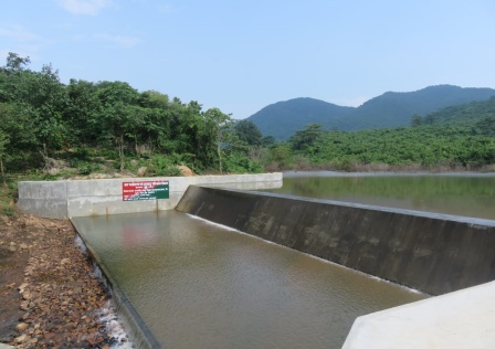
- (V)Dams: Panchet Dam and Maithan Dam are situated in Dhanbad with a developed township and breathtaking views of the dam surrounded by forested hills.
NTFP
Important NTFP of the forest of Dhanbad area Kendu Leaves, Sal Seed ,Oil Seeds Produced from Mahua, Karanj and Kusum. The corolla of Mahua flowers is collected on a very large scale from trees growing inside and outside forest. The fruit of Harra, Bahera and Amla collectively known as myrobalans have since long been collected for medicinal use.
The major tree species whose bark is used for tanning are Asan (Terminalia tomentosa) and Kahua or Arjuna (Terminalia Arjuna). The Asan trees are scattered all over the forest but the Arjuna are found mainly along the nalas.